Why Corinth?
At the time of Paul’s visits to Corinth it was a thriving commercial city of over 200,000 people.
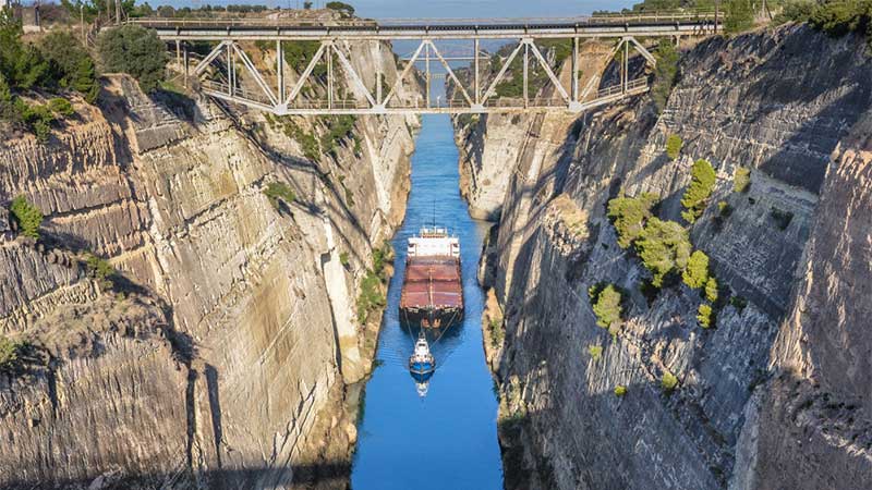
Corinth was situated in the northeastern corner of the Peloponnese — very near the narrow land bridge (isthmus) that connected the Peloponnese to the mainland of Greece. Its strategic location was enhanced due to its proximity to the diolkos — the stone-paved roadway that connected the Saronic Gulf with the Gulf of Corinth. By using this overland passageway, passengers and cargo avoided the difficult and time-consuming trip around the southern end of the Peloponnese.
The Greek city of Corinth had been (partly) destroyed by the Romans in 146 B.C., but the rebuilding process, as a Roman city, had begun by 44 B.C. For a long time it had been famous for its immorality (think prostitutes associated with the Temple of Aphrodite) and its commercial character. Its two harbors were Lechaion (Gulf of Corinth) and Cenchreae (Saronic Gulf). Every two years important games were held at nearby Isthmia.
Paul spent 18 months here on his second journey and maybe three months on his third. The letters of first and second Corinthians were written to the church here, and Paul probably wrote first and second Thessalonians and Romans while in Corinth.
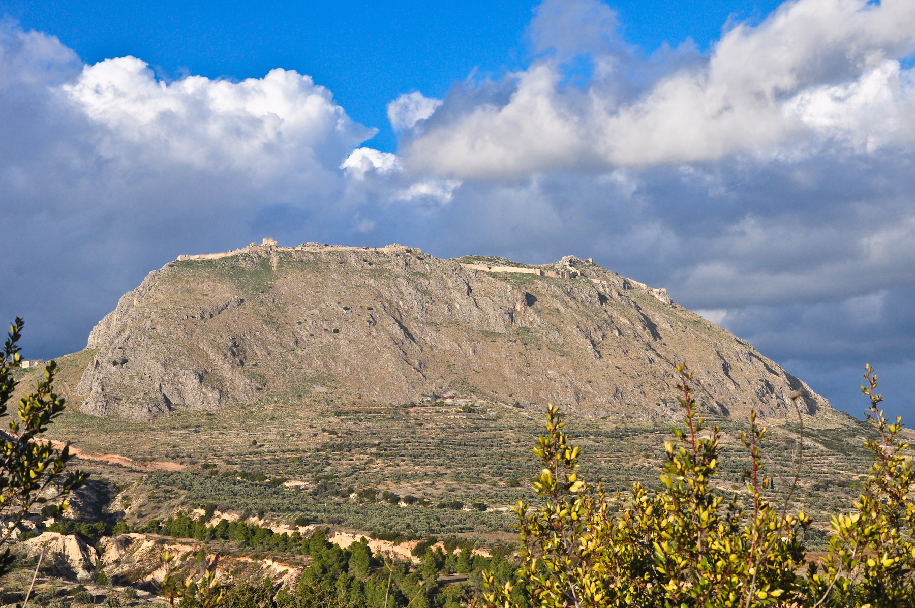
Acrocorinth
The “Acrocorinth” is the acropolis (citadel) of Corinth. It is situated to the southwest of the ancient city and rises to an elevation of 1883 ft. [574 m.]. Today it is surrounded by walls that are about 1.85 mi. [3 km.] long.
The foundations of the fortifications are ancient—going back to the Hellenistic Period. The current walls were built and rebuilt by the Byzantines, Franks, Venetians, and Ottoman Turks.
The entrance to the Acrocorinth is from the west where the approach is most gentle.
loading map - please wait...
The source of this article is quoted as the HolyLandPhotos’ Blog